
Street names can tell us a lot about the history of the town. Our roads and thoroughfares are named after people, pubs, activities and events. This gallery looks at some of the town's street names and how they were come by.
Scroll down to find out more about the background to some of Hertford's street names.
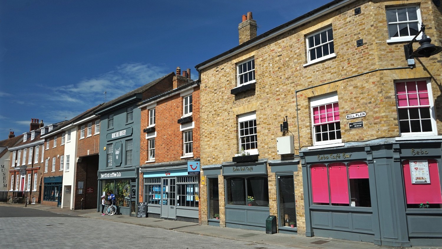
Bull Plain used to host a cattle market.
The Bull Inn was on the west side of the street at no.15.
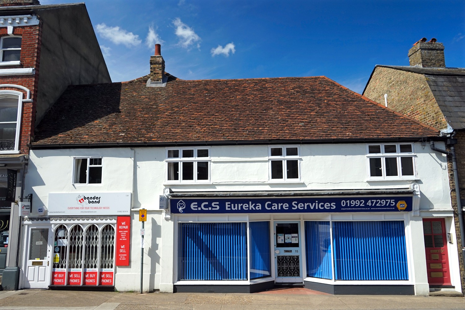
The premises are now Eureka Care Services, after being a camera shop for many years and more recently a bridal dress shop.

Parliament Square was created in the years following the first world war when shops and buildings were cleared for the war memorial.
Designed by Sir Aston Webb and built from Portland stone, the memorial was unveiled in 1921.

The hart that sits at the top of the memorial is the work of sculptor Alfred Drury.
The cottages on the west of the square were originally known as Parliament Row - a name that may relate to the relocation of the law courts and government officials to Hertford during The Plague.

Few of the old buildings remain along this stretch, most having been demolished in the late 1920s. The three cottages at the end in the middle of the picture are now used for retail.

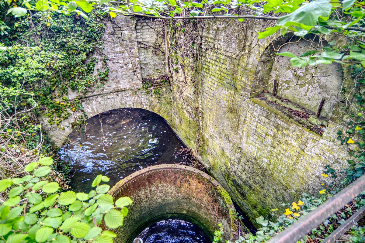
Mill Bridge crosses the River Lea between Old Cross and The Wash, just a few metres west of the original ford after which the town is named.
The current bridge was built around 1927 and replaced an earlier bridge that until 1893 charged a toll.

A mill stood on the site for over 1000 years, the most recent being Illots mill, which was demolished in 1967 to make way for Hertford Theatre.

This recent development by Redrow is next to Hertford East Station in Mill Road.
Claud Hamilton was the chairman of the Great Eastern Railway from 1893 to 1922.
The House of Cecil has given us a number of place names in Hertford. As well as Salisbury Square and The Salisbury Arms, we have Cecil Road and Gascoyne Way (after Gascoigne Cecil. Marquis of Salisbury).
Named after Sir Thomas Byde, Recorder of London and Member of Parliament for the town, who rebuilt the mansion at Ware Park.

Byde purchased Ware Park from Sir Thomas Fanshawe in 1668 and set about demolishing the Tudor mansion. The family owned Ware Park until 1846.

Most likely named for the market cross that stood here, indicating a place for markets and fairs.
The cross was eventually replaced with a wooden pillar, surmounted by a vane. This structure stood until the late 18th century.

The Andrews & Wren plan of Hertford in 1766 shows the pillar marked as "Dial".
Early Hertford was two boroughs separated by the river. Each had it's own churches and market places.

This gap provides a gateway in to the town from Bengeo and beyond and probably derives its name from the Latin porta (a gate).
The road to Dicker Mill originally ran from Railway Street but was extended to the Ware Road in the early 1980s when Tesco was built. It has also be known as Sow Lane.

The Mill was located on the north side of the River Lee and originally milled corn, although by the early 18th century it was extracting oil from seeds.

The mill closed in the 1920s and has since been demolished, although remains can be found close to the industrial estate that has grown up on the site.
Dicker Mill was just one of a number in Hertford, including the Ilott's Mill, Horn's Mill, Sele Roller Mills, Ware Park Mill and Molewood Mill.

Cockbush Field is the land to the east of Hertford along the Ware Road, lying between the King's Meads at the bottom of the valley of the River Lea and the higher ground to the south.

During the English Civil War, Oliver Cromwell's troop assembled in Cockbush Field in preparation for a march on London. A disloyal regiment led by Colonel Robert Lilburne planned to murder Cromwell. However, the plot failed and 11 mutineers were put on trial.
The English Civil War has given names to four streets in the town. In addition to Mutiny Close there are also Cromwell Road - named after Oliver Cromwell; Fairfax Road - named after Sir Thomas Fairfax; and Lilbourne Drive - named after Col.Robert Lilburne who led the mutiny against Cromwell in 1647.

Early in the town's history there were two market places north and south of the river and toll bridge. The 'northern borough' held markletand fairs in Old Cross whilst the 'southern borough' conducted business in Market Place.
A cattle market was also held in nearby Fore Street before moving to land behind The Ram, and later to Caxton Hill.

This illustration of Hertford Market in 1800 is by Thomas Rowlandson. The original is in Hertford Museum.
Shire Hall was built between 1767 and 1769, replacing an earlier timber-framed Elizabethan town hall.

The monthly farmers' market is still held in Market Place, selling local produce such as meat, eggs, baked goods and alcoholic beverages.
Market Street was created in 1890 to allow the market to move from Market Place.

The work involved demolishing a number of shops next to the Corn Exchange in order for the road to be built. The covered market was built around the same time.

In the 1920s the market moved again to Bircherley Green following the earlier slum clearance.
In the next part of this feature we'll look at Maidenhead Street, Chambers Street and both of the town's Brewhouse Lanes. Coming late summer.
You can find out about more of Hertford's street names by visiting our history section.
Want to read the second instalment of this feature? Check our our second Street Names gallery.

